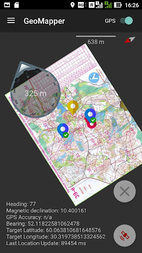
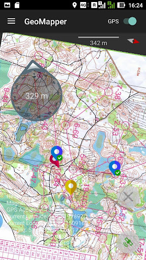
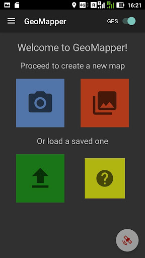
The GeoMapper app is designed for binding raster maps to geographic coordinates. So it allows you to use any image taken from the gallery or right from your camera as a digital map with geopositioning and even navigation.
All you need to do is to assign two or more reference (calibration) points on the map with real coordinates. The more points you add, the better results you get. Having multiple points the app is able to correct distortions like scale irregularities, crumples and perspective.
Features:
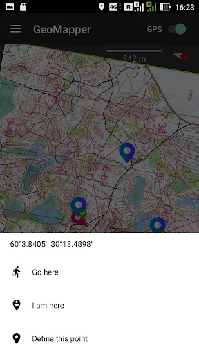
- Create reference points using your current location, absolute coordinates or distance and bearing from your current spot.
- See your position and your course over the map.
- Save referenced maps for later usage.
- Scale, rotate and drag the map to distinguish the needed details.
- No Internet connection required.
- GeoMapper can lead you to the desired place. It will show you the direction to move and the distance left to go in real time (if your device has a magnetic sensor).
- GeoMapper will compensate the geomagnetic declination to show you the accurate direction.
ATTENTION!
This is an evaluation version. It works only within 100 meters from the reference points.
Support for high resolution images without losing the quality.
Autosave for map changes.


9Apps 4.9