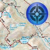
Tom Harrison Maps
Tom Harrision Maps publishes the best full-color, shaded-relief topographic maps for hiking, backpacking, and mountain biking in Parks, Forests, and Wilderness Areas in California.
Available Tom Harrison Maps:
Death Valley National Park
Joshua Tree National Park
Kings Canyon High Country
Lake Tahoe
Mammoth High Country
San Gorgonio Wilderness
Available Free OpenStreetMap Maps:
California
Arizona
Utah
Nevada
Oregon
Washington
Features:
High-Resolution Tom Harrison Maps
Detailed and current OpenStreetMap background
Waypoint import/export
Track and save to KML or GPX
Email saved track and waypoint files
Works where cellular signal does not reach!