Marine Navigator Lite icon

Marine Navigator Lite

1.1.1 for Android
3.8 | 500,000+ Installs | Reviews

Ronald Koenig

Description of Marine Navigator Lite

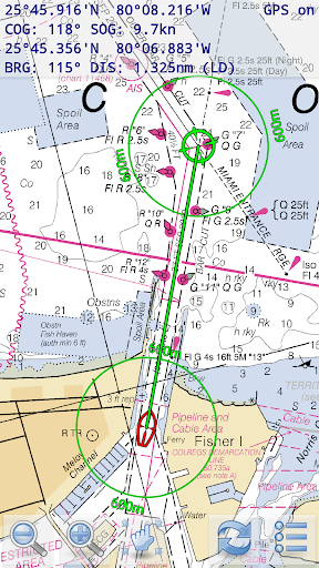
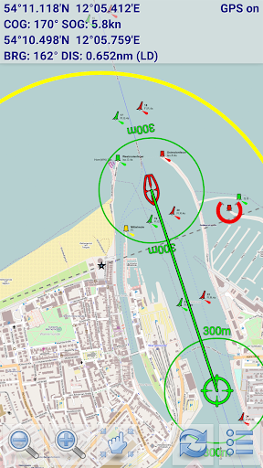
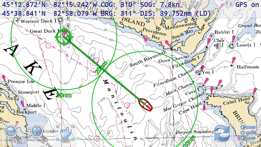
Marine Navigator Lite is an offline navigator using raster navigational charts (RNC's) to plot your position in real time. This way you can navigate with true copies of official paper charts on your mobile device. This lite version of the Marine Navigator provides the following basic navigation functions:
* real time positioning (instantly shows vessel's position and course on the chart)
* display of navigational data (position, speed over ground, course over ground)
* distance and bearing calculation
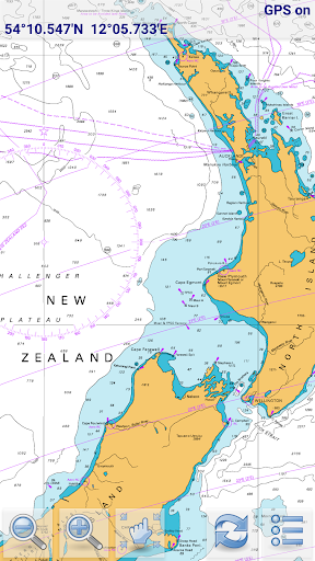
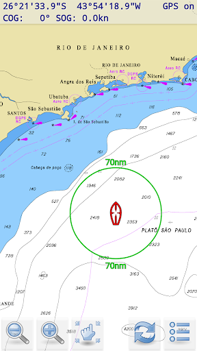
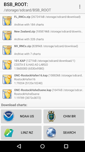
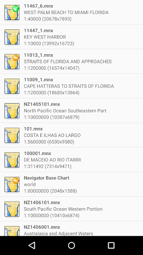
Marine Navigator Lite doesn't come with pre-installed nautical charts. Instead it is able to import BSB/KAP raster navigational charts (see menu->help for instructions). RNC's are available for free at various internet sites:
*http://www.charts.noaa.gov/RNCs/RNCs.shtml (Suite of NOAA nautical charts that covers the coastal waters of the U.S. and its territories)
* http://www.mar.mil.br/dhn/chm/box-cartas-raster/raster_disponiveis.html (Suite of CHM nautical charts that covers the coastal waters of Brazil and its major rivers)
* http://www.linz.govt.nz/hydro/charts/digital-charts/nzmariner (NZMariner is the product name of New Zealand's Official RNC folio.)
* http://www.openseamap.org (Openseamap charts are based on Openstreetmap data enriched with additional nautical information. The charts cover selected european coastal waters).
If you like Marine Navigator Lite and are looking for enhanced navigational functions check out the full version of MARINE NAVIGATOR.

Information

  • Category:
    Travel & Local
  • Latest Version:
    1.1.1
  • Updated:
    2016-07-23
  • File size:
    1.9MB
  • Requirements:
    Android 2.1 or later
  • Developer:
    Ronald Koenig
  • ID:
    de.kemiro.marinenavigator
Reviews
  • avatar
    Importing a set of maps for just one state took a long time. After completion the app used almost 500MB of internal storage! No obvious way to import them onto the SD card. Map image was great but only one map segment at a time is shown rather than stiched contiguous segments. Segment must be selected from long list with small font that would be hard to read in the sun. Zooming in and out is only done with the +/- icons. Promising concept but not so useful as installed.
    2020-08-09 05:46
  • avatar
    excellent app i use this for cjarys and as backup to chartplotter on my small 16' runabout on the great lakes
    2020-05-17 05:39
  • avatar
    Back to 5 Stars. Had problems with disappearing soft menu button on Galaxy Tab S3 due to Samsung upgrade in Oct 2019. Problems all resolved in latest upgrade and developer was great with email communication. Thanks also to Steve at VMH who helped isolate the problem and provided advice to get charts up and running again, along with recovering routes and waypoints. Buy and use with confidence - MN and VMH provide the best combination of all offerings in my opinion - with great backup.
    2020-02-18 12:00
  • avatar
    This app deserves a MUCH higher rating than 3.6. It will always show you your position on indispensable NOAA charts, which are free, and you can just touch a destination to get a bearing and distance- simple with no clutter. If you are too clueless to fetch the free charts, don't drag the rating down with 1 star reviews. Put the map zip files anwhere you like and read the extensive help files to tell the app where to find them. No need to decompress the zip files- the app does it.
    2019-07-19 11:49
  • avatar
    not a keeper
    2019-03-22 04:20
  • avatar
    Lame navigation program, depth in meters only, don't waste your time!!!!!
    2018-12-22 01:44