Enjoy the most popular apps here! 20,000+ users downloaded Chemins de Bretagne latest version on 9Apps for free every week! This will give an informative for the other crazy players. This hot app was released on 2017-09-28. Why not download and play it now?
The "Chemins de Bretagne" was intended to facilitate the routing on hiking routes described on the website "cheminsdebretagne.com".
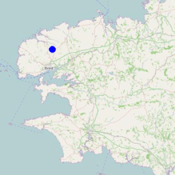
His main interest is to show you quickly where you are in relation to the route you have chosen. Your position appears on a map as well as the chosen route. The application also facilitates the location field by providing a description in the form of text, almost all crossings and junctions that can be found on the routes.
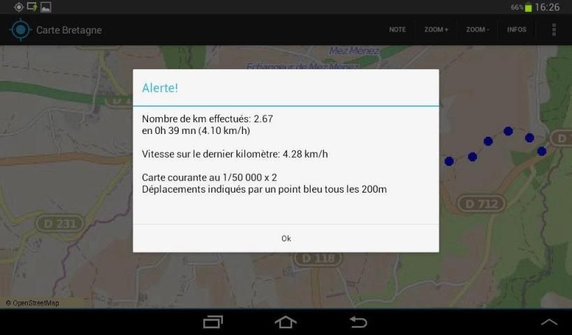
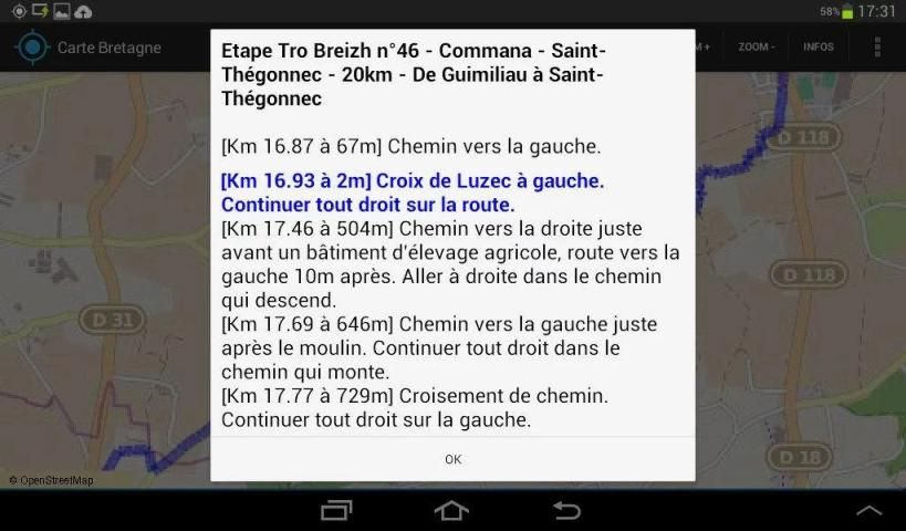
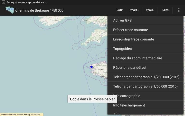
On the field, the application uses very simply, is launching application, selecting a route, the current zoom, and that's it. The route to follow is automatically displayed on a map as a blue solid line. Blue dots appear on the map as and as we advance to indicate the progress. instantly seen if we followed the chosen route, or if it has deviated. When we arrive at a crossing or a fork, if you want to get text information on this intersection (turn right, go straight, ...), you press the "Note" button. The distance between where you are and crossing described
is also displayed. A displayed distance less than 30m (normal precision GPS) usually means the intersection described corresponds to the position where it is.
application performance will be directly related to the GPS performance of the smartphone use. significant variations are observed smartphone model to another. If the smartphone GPS provides incorrect values, that is to say if the error exceeds 30 or 50 m, the application also may provide false information. If the smartphone GPS malfunctions or fails, the application will do the same. On some smartphones, there is a significant loss of accuracy in the valleys or in the woods.
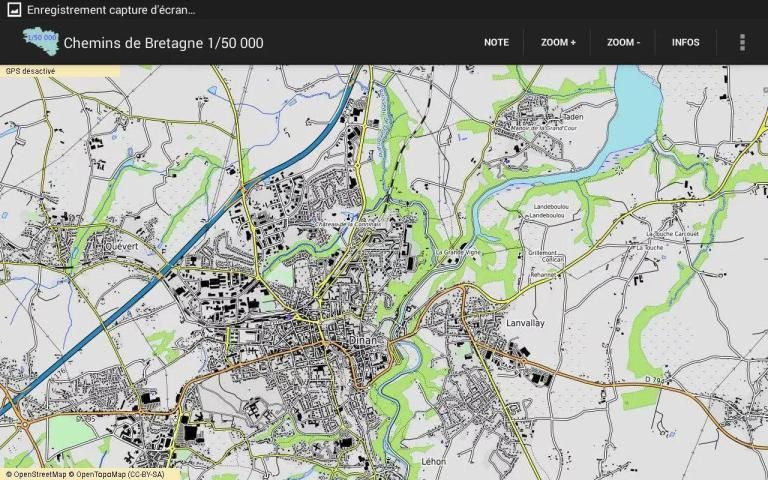
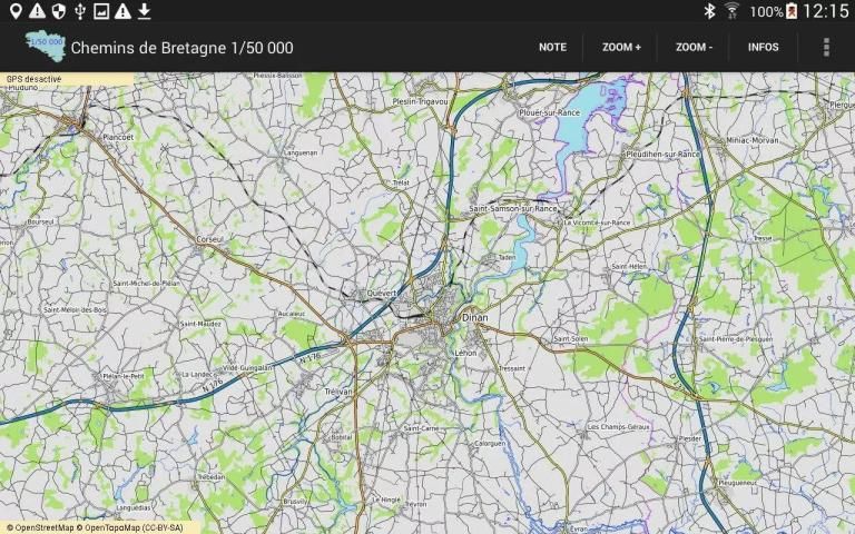
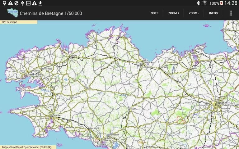
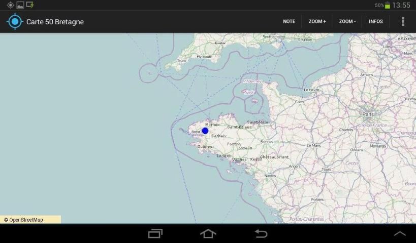
The "Chemins de Bretagne" contains 000 cards 1/200 of Britain and maps to 1/50000 in the vicinity of hiking trails in the implementation. To get the mapping to 1/50000 of the whole of Brittany, use the application "Chemins de Bretagne +". The maps were produced from OpenStreetMap data using OpenTopoMap style.
In user mode, the application only uses preloaded maps that are automatically selected based on the current GPS position. The application uses the network to preload the cards. This is done in one go. The entire map is stored in embedded files.
The application displays maps so that the center of the map always corresponds to the current GPS position, unless you have manually moved the map by dragging it, and in the latter case, the automatic centering on the GPS position reactivates automatically after 30 seconds. When it moves, whether on foot, bike or car, the map moves and automatically center on the current GPS position. A blue dot appears on the map to indicate the current GPS position. The trips are displayed as blue dots smaller.
Works on tablet and smartphone. We need 100MB of free SD card for downloading cartography.
The application has been tested on Samsung Galaxy Tab3, TAB 4, Y, J1. There are a multitude of Android devices and it is possible that the application works poorly, if at all, on some of them. In that case, thank you to report the problem.
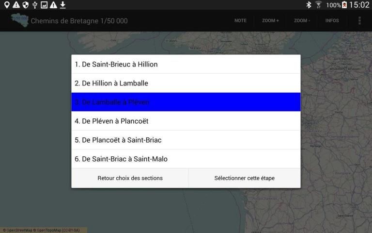
Screenshots: map display, selecting a route in the guidebook, display the selected path, display guidance information in the field.
9Apps 4.9


![Eagles - Hotel California (Live 1977) (Official Video) [HD] screenshot 5](https://i.ytimg.com/vi/09839DpTctU/mqdefault.jpg)