Šmarje pri Jelšah2go is a mobile guide for planning hiking and cycling tours around Šmarje pri Jelšah.
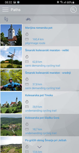
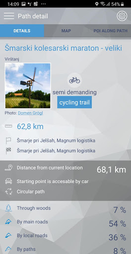
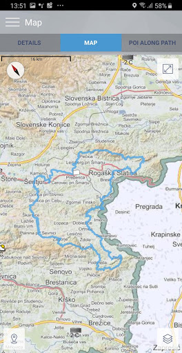
Trails are described in detail with: length, estimated time, level of difficulty, description of the trail, photos, elevation data with elevation profile and nearby points of interest. Each trail is checked and verified whether it is family friendly, how much of the trail leads through the forest, main and side roads.
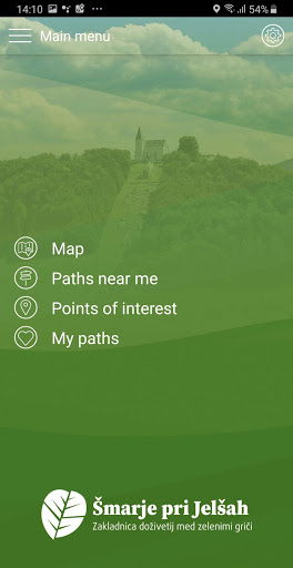
Included trails:
HIKING TRAILS
• Marijina romarska pot
• Po gričih okrog Šmarja pri Jelšah
CYCLING TRAILS
• Šmarski kolesarski maraton (mali)
• Šmarski kolesarski maraton (srednji)
• Šmarski kolesarski maraton (veliki)
• Kolesarska pot Rogaška Slatina
• Kolesarska pot Sladka Gora
• Kolesarska pot Tinsko
Trails and points of interest are shown on a detailed topographic map (Monolit maps).
Main advantages of the Šmarje pri Jelšah2go app:
- You can save data for the selected trail on your mobile phone’s internal storage and use it without a network connection.
- You can view your current status on the trail and a distance to finish.
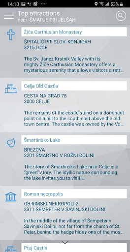
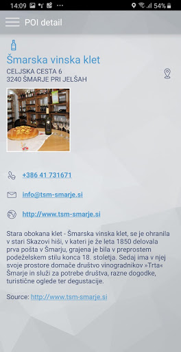
- You can search or browse more than 30,000 points of interest, e.g.: top 50 Slovene attractions, natural and cultural attractions, restaurants and mountain huts. All interesting points of interest include detail description with photos.
Application is currently available in Slovene and English language.
9Apps 4.9