Hot applications make large number of downloads. 10,000+ users downloaded Flood Maps latest version on 9Apps for free every week! If you are not comfortable with the old version then you can updated it right now. This hot app was released on 2013-04-20. For more mobile apps information, you can go to our official website - 9Apps.
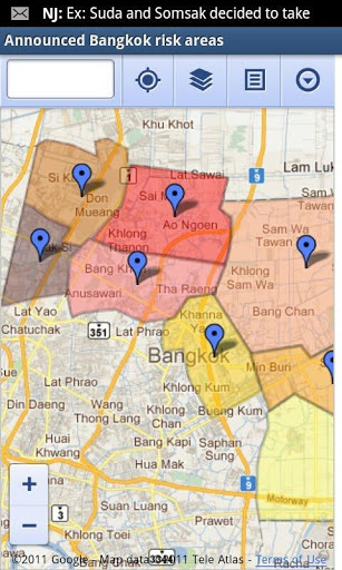
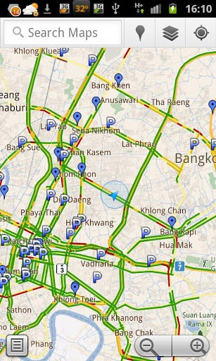
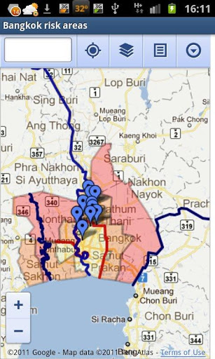
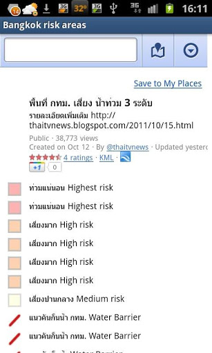
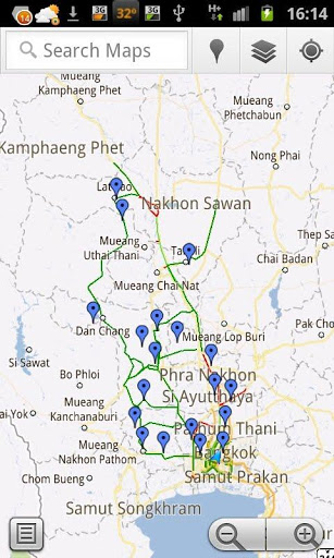
This app collects useful maps created during the 2011 Thailand Floods. These maps are created by many sources available online e.g. Google Crisis Response Thailand Floods 2011, thaiflood.com, Thaitvnews, Department of Highways, etc. The purpose of this map is to make these information more useful by integrating them with the google map App on your Android phone. By utilizing the power of Layers, you can see floods information in the same map as other layers e.g. Traffic, your current location, Latitude layer, etc. You can even use the Google Map to find a direction to parking area, donation points, shelters, etc. We hope this app can help some or many people affected floods. We hope this crisis is resolved soon. 2554 Google Crisis Response 2554, thaiflood.com, Thaitvnews, Google Map Google Map , , , Google Latitude Google Map
9Apps 4.9